News

CAGIS Student Research Presented at 2026 UCGIS Symposium
Charlotte, NC — The Center for Applied Geographic Information Science (CAGIS) is pleased to highlight recent student research presented at the 2026 UCGIS Symposium, held June 15–18, 2026, at the University of Maryland, College Park. This year’s symposium, themed “AI Everywhere!,” brought together the GIScience community to explore how artificial intelligence is reshaping geospatial research, […]
CAGIS Supports REMUS Students Through Geospatial Research Resources
The Center for Applied GIScience (CAGIS) at UNC Charlotte is pleased to support students participating in the Research Experiences and Mentorship in Urban Systems (REMUS) program. As part of their summer research experience, these students are using CAGIS resources to support their work in geospatial research, applied GIScience, data-driven analysis, and urban systems studies. The […]
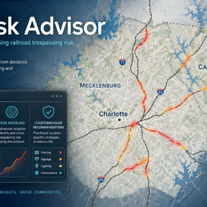
CAGIS Receive TRB Rail Safety IDEA Funding for RailRisk Advisor Project
Charlotte, NC — Researchers at the Center for Applied Geographic Information Science (CAGIS) have received funding from the Transportation Research Board’s Rail Safety IDEA program for a new project titled RailRisk Advisor: A Web-GIS Tool for Assessing Railroad Trespassing Risk and Recommending Countermeasures. The 18-month, $100,000 project will begin on July 1, 2026, and will […]

CAGIS Receive School of Data Science Funding to Develop Digital Twins for Public Health
The Center for Applied GIScience (CAGIS) is pleased to announce that the project “Digital Twins for Public Health: Coupling Human Mobility and Airflow Dynamics for Indoor Viral Transmission” has received $16,000 in funding from the UNC Charlotte School of Data Science. The project is led by Dr. Yao Li, Dr. Xuyang Li, and Dr. Don […]

Celebrating GIS Day 2025!
Thanks everyone who joined us in recognizing the power of GIScience and the amazing community behind it. This year’s GIS Day was our most dynamic yet, filled with creativity, collaboration, and excitement! 📊 Event Highlights Your engagement made the event vibrant and inspiring! Competition Winners GeoVisualization Competition Undergraduate Competition 🥇 Monica Layug — BRIDGING THE […]
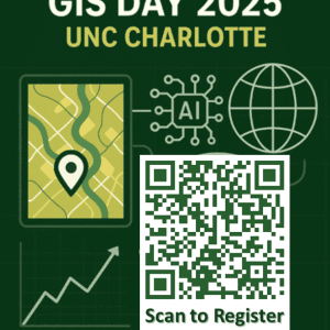
Celebrate GIS Day 2025 at UNC Charlotte!
Date: November 19, 2025Time: 10AM – 2PMLocation: McEniry Hall, UNC CharlotteTheme: Exploring the Power of Geospatial AI Add to Calendar Center for Applied GIScience (CAGIS) invites students, faculty, companies, and organizations to celebrate GIS Day 2025, a global event recognizing the transformative power of Geographic Information Systems (GIS). The theme of this year highlights the […]
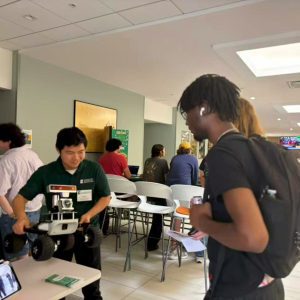
CAGIS at the EEGS Open House!
On October 1st, 2025, the Center for Applied GIScience (CAGIS) had the opportunity to showcase some of our exciting technologies at the EEGS Open House. Our team demonstrated:Augmented Reality (AR) Sandbox – allowing participants to explore topography and water flow in real time.Unmanned aerial vehicle (UAV) – highlighting how UAVs (i.e., drone in the demonstration) […]
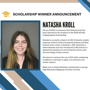
CAGIS Undergraduate Wins 2025 NCAUG Undergraduate Scholarship
Charlotte, NC — September 4, 2025. CAGIS undergraduate Natasha Kroll—a senior double major in Earth & Environmental Science and Data Science, with a minor in Statistics—has been awarded the 2025 North Carolina ArcGIS Users Group (NCAUG) Undergraduate Scholarship. The NCAUG scholarship recognizes undergraduate students whose studies and projects advance North Carolina’s geospatial industry across public […]

Expanding Opportunities: EEGS Becomes Member of UCGIS
With the support of our department and the Center for Applied Geographic Information Science (CAGIS), we are excited to announce that EEGS has become a member of the University Consortium for Geographic Information Science (UCGIS), making us the second institution in North Carolina to join after NC State. This membership means that all our students, […]
Empowering Geospatial Research Through High-Throughput Computing: CAGIS at OSG School 2025
During June 23–27, 2025, CAGIS post doctoral fellow, Dr. Tianyang Chen, participated in the OSG School 2025, held at the University of Wisconsin–Madison. The week-long summer school offered hands-on training in utilizing HTC system, the national-scale Open Science Pool (OSPool), to execute large-scale computing tasks essential to modern science. Integrating HTC into GIScience For CAGIS, […]