Complexity in Coupled Human-Natural Systems
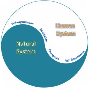
Space-time complexity in Coupled Human and Natural Systems (CHANS) has intrigued interdisciplinary researchers. CHANS is characterized by a suite of complex properties, including self-organization, nonlinearity, emergence, adaptation, and path dependency. To understand these complex properties requires support advanced spatiotemporally explicit modeling approaches and state-of-the-art computational support–i.e., the couping of spatiotemporal and computational thinking.
Representative modeling approaches that we have been using include cellular automata, agent-based models, and computational intelligence.
*** Current Project ***
Spatially explicit simulation of land development coupled with smart growth and land conservation
CAGIS members: Dr. Wenwu Tang. Wenpeng Feng
Smart growth is typically applied in urban plan and design aiming at achieving ecological, social, and economic sustainability. Coupling Land conservation with smart growth provides sustainable urban development by restricting urbanization close to urban area instead of rural area, guiding the resolution of potential sprawl issues in land development. However, due to complexity in stakeholder decision making and spatial-temporal heterogeneity in land systems, spatial models of land development often require capabilities of simulating, predicting and visualizing land cover change that explicitly takes into smart-growth activities.
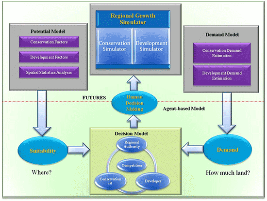
In this study, we propose a spatially explicit model that incorporates smart growth strategies to combat the sprawl of rural-urban transition in land development. This spatially explicit model consists of an agent-based model of smart growth and a cellular automata model of land change. The agent-based model is to represent complex human decision making processes associated with smart-growth strategies. The cellular automata model, referred to as the FUTure Urban-Regional Environment Simulation (FUTURES) model, simulates multi-level land conversion empirically. The integrated model framework can help land policymakers to gain more insight on mechanisms of land conservation with smart growth strategies in a spatially explicit manner.
Owing to our interest of land conservation in mountainous area, we choose Ashville, North Carolina, including 4 counties in a mountainous area, as our study region. There are multiple ecological and economic driving factors across spatial and temporal scales influencing land cover change. The connection between transportation and land conservation with smart growth strategies is analyzed through different scenarios. To handle the computing issue of empirical data and simulation leads to the introduction of a cyberinfrastructure-enabled high-performance computing approach to substantially facilitate the computation of this spatially explicit model.