SMART-SLEUTH
Click here to visit our Web GIS portal
Objectives
- Develop SMART-SLEUTH, an advanced spatially explicit modeling framework designed to augment the current SLEUTH model with sophisticated smart-growth capabilities.
- Create and maintain an open-source, GIS-enabled software package to implement SMART-SLEUTH with tools that facilitate the evaluation, prediction, and visualization of impacts of smart growth outcomes.
- Conduct scenario analyses to assess the impacts of smart-growth practices in the entire South Atlantic region.
Framework
Smart-growth policies and practices hold great potential for resolving conservation-development conflicts, promoting quality of lie, and provisioning sustainable ecosystem services. This project is to develop SMART-SLEUTH, and advanced spatially explicit modeling framework based on an open-source software package.
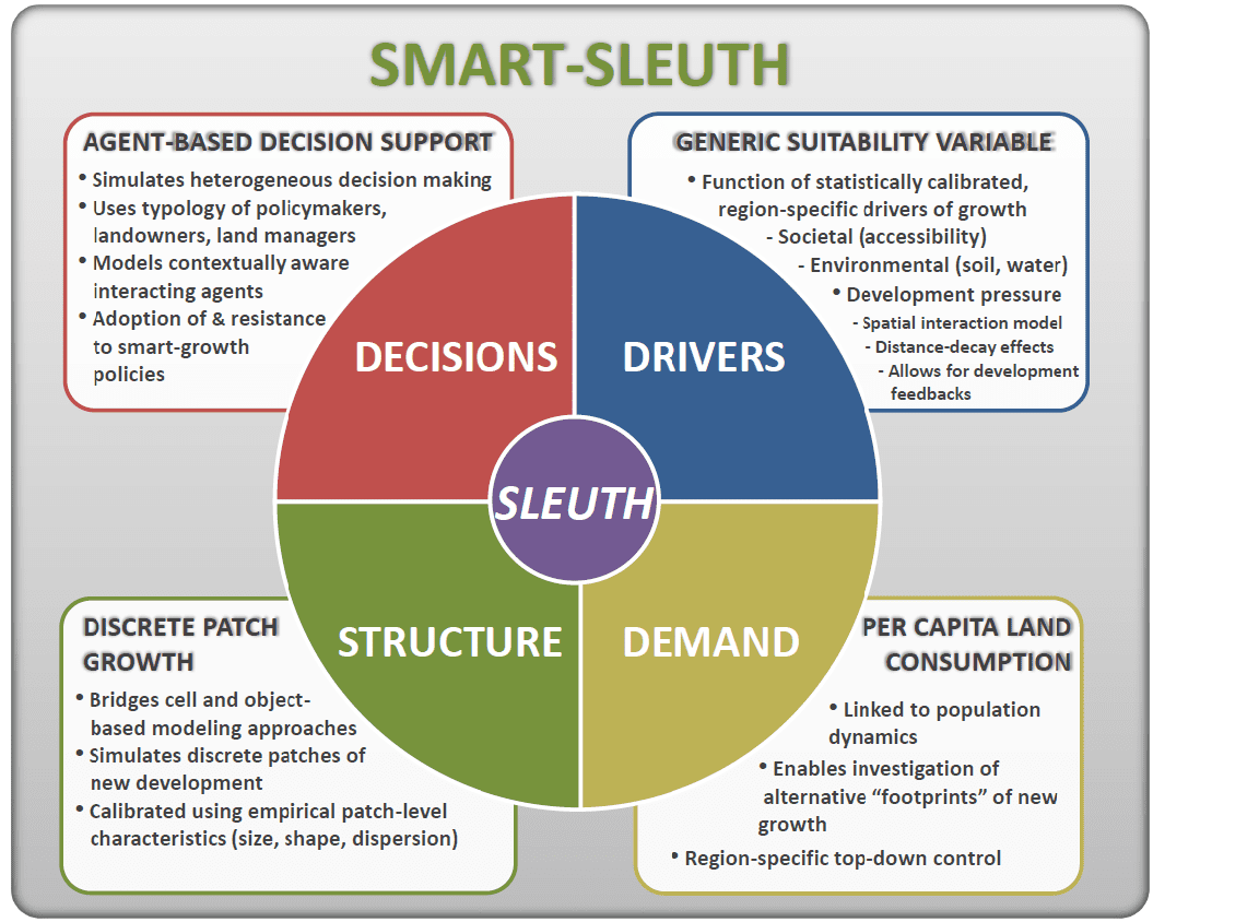
Figure 1. Framework of Smart-Sleuth
Study Area
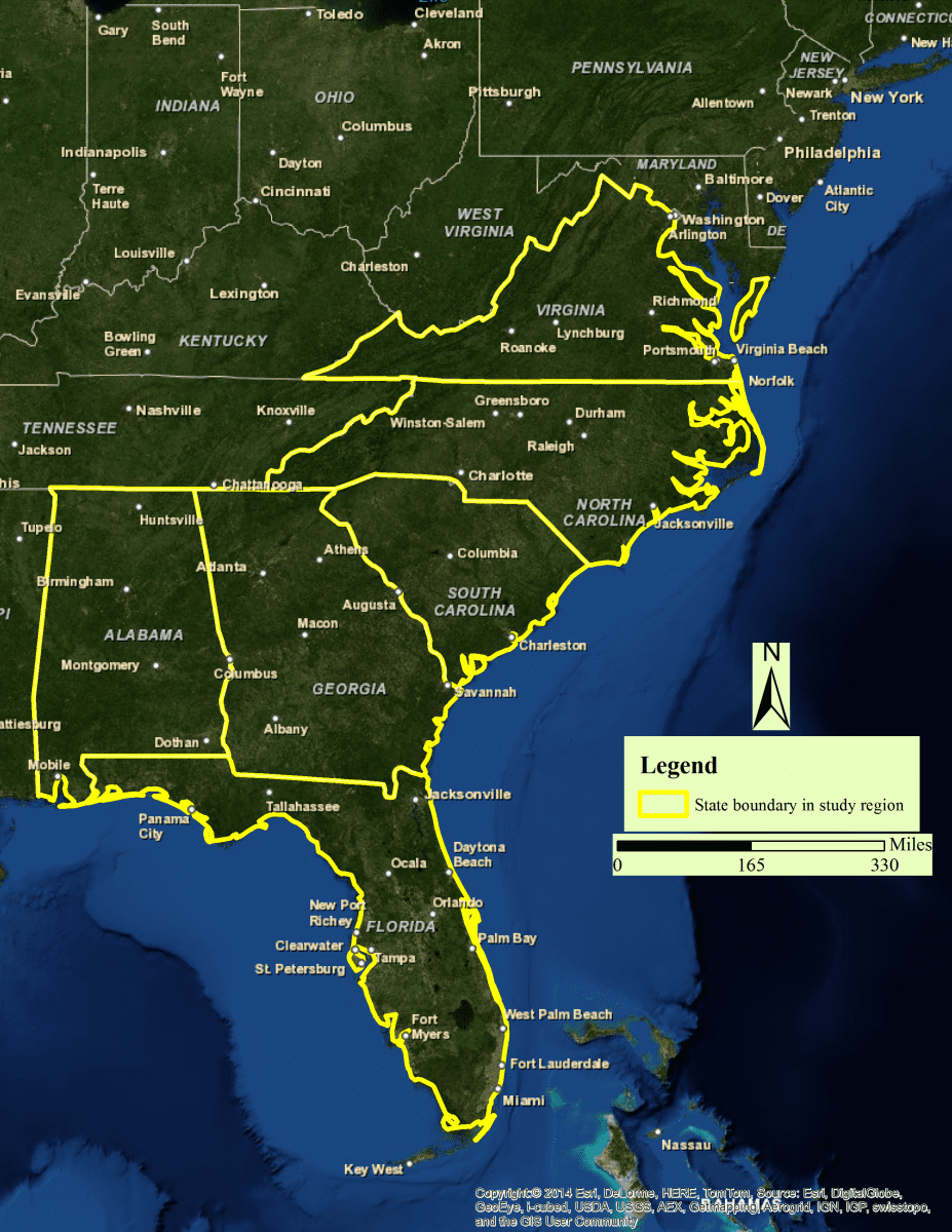
Figure 2. Study area of Smart-Sleuth
GIS Input Layers for Study Area (click to download)
Data (click to download)
- Population (historical and projection)
- County boundary
- Road netwok
- Refuges
- Wetlands
- Parks
- Land cover
Tool (click to download)
- Data extraction tool
- Visual model configuration tool
- Automatic parallel calibration tool for SLEUTH model