News
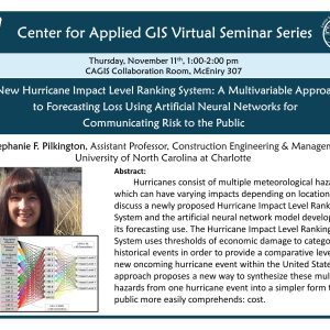
CAGIS Virtual Seminar, Thurs Nov. 11, 1:00 PM: Hurricane Impact Level Ranking System
Please join us this Thursday when Dr. Stephanie Pilkington discusses the proposed “Hurricane Impact Level Ranking System.” Dr. Pilkington is an Assistant Professor in Construction and Building Engineering here at Charlotte,. She is also a collaborator in our R1 nomination, “Geospatial Analytics for Healthy & Resilient Urban Systems” as well as a Lead PI for […]
Select CAGIS Seminars are now available on YouTube
October, 2021. Due to popular demand, we have begun recording and sharing presentations that are part of the CAGIS Virtual Seminar Series. If you miss a speaker or topic of interest, please check here. Like and Subscribe!
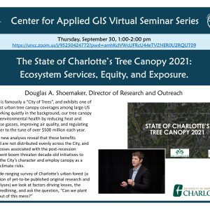
CAGIS Virtual Seminar, Thurs. Sept. 30: The State of Charlotte’s Tree Canopy 2021
Charlotte is famously a “City of Trees”, and exhibits one of the highest urban tree canopy coverages among large US cities. Working quietly in the background, our tree canopy supports environmental health by reducing heat and greenhouse gasses, improving air quality, and regulating stormwater to the tune of over $500 million each year. However, new […]
CAGIS, UNC Pembroke secure funding to build a collaborative Geoscience learning environment
CHARLOTTE, NC, Aug. 2, 2021–CAGIS announced it is receiving funding from UCAR (University Corporation for Atmospheric Research) UniDATA program. The funded project is entitled “Remote Collaborative Geoscience Learning through Distributed File Servers and Dedicated Web Server System”. PIs of this project are Dr. Xin (Cynthia) Zhang (UNC Pembroke), CAGIS Executive Director Dr. Wenwu Tang, and […]
Shoemaker talks the future of Charlotte’s tree canopy on the “Future Charlotte” podcast
July 15, 2021. Many Charlotteans enjoy the natural amenity provided by its prominent urban forest, so much so that we’ve become known as “The City of Trees.” However, this lush urban tree canopy is under threat and losing hundreds of acres per year, mostly in residential areas, leaving the City hotter and more prone to […]
CAGIS receives a new award to explore risk, resilience in freight transportation systems [NCDOT: Geo-FRIT]
We are pleased to announce the award of NC Department of Transportation funding to CAGIS to explore risk and resilence in freight transportation systems. The proposal is entitled “Geo-FRIT: A web-based geospatial analytics tool for quantifying freight risk and resilience in transportation”. CAGIS will play a leading role in this project by developing this web-based […]
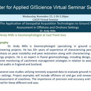
CAGIS virtual seminar: Using Remote Sensing (incl. Drones) to assess Risk [Mills]
Please join us this Wednesday at 1:30 when we hear Geomorphologist Dr. Andy Mills talk about assessing risk for engineering projects using cutting-edge technologies. The Application of Geospatial Acquisition Technologies to Ground Risk Assessment in Offshore and Onshore Settings Abstract This seminar will present several case studies utilizing remotely acquired data to evaluate ground risks […]
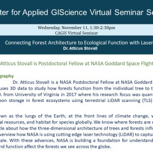
CAGIS virtual seminar 11/11: NASA scientist Atticus Stovall explores forest structure with LiDAR
Please join us this Wednesday at 1:30 when we hear NASA scientist Atticus Stoval talk about new methods in measuring 3D forest structure using exciting tools like Terrestrial LiDAR! Abstract Forests are known as the lungs of the Earth, at the front lines of climate change, while providing a litany of ecosystem services, natural resources, […]
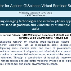
CAGIS Virtual Seminar Series 10/28: Addressing land degradation challenges in southern Africa using technology and interdisciplinary approaches
Please join us Wednesday at 1:30 when we hear Dr. Narcisa Pricope from UNCW’s Socio-Environmental Analysis Lab talk about her strategies for conducting multiscale analyses in complex socio-ecological systems, such as those in the trans-frontier region of southern Africa. Dr. Pricope embraces the concept of “Big Tent” research, where collaborations tackle “wicked” problems (as defined […]
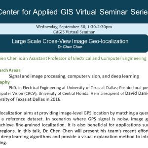
CAGIS Virtual Seminar 9/30, 1:30 pm : Application of Deep Learning to Image Geo-location, Dr. Chen Chen
We invite you to participate in Wednesday’s CAGIS Virtual Seminar where we hear from Dr. Chen Chen, Assistant Professor in the Department of ECE at UNCC, talk about his team’s recent effort on cross-view image geo-localization using advanced deep learning algorithms. Join with Google Meet meet.google.com/pid-xjwj-vwz Up to 250 participants Meeting ID meet.google.com/pid-xjwj-vwz […]