GIS Day 2026: Competitions for Amazon Gift Card Prizes
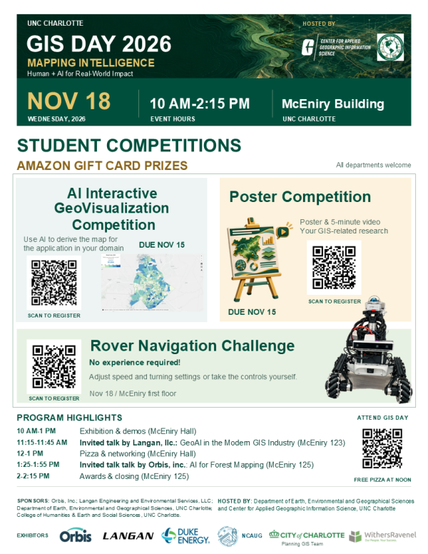
Mapping Intelligence: Human + AI for Real-World Impact
Join us for UNC Charlotte’s GIS Day on Wednesday, November 18, 2026, from 10:00 a.m. to 2:15 p.m. in the McEniry Building. The Department of Earth, Environmental and Geographical Sciences and the Center for Applied Geographic Information Science (CAGIS) invite students, faculty, staff and community partners to explore how mapping and AI can help address real-world questions.
This year’s program brings together student competitions, industry presentations, exhibitions and demonstrations. Students from all departments are welcome to take part, share their research and meet professionals who use geospatial technology in their work. Amazon gift card prizes will recognize student competition winners.
Register for GIS Day 2026. Free pizza will be available at noon for attendees who register and vote in the student competitions.
Three Student Competitions
AI Interactive GeoVisualization Competition
Explore how AI can support mapmaking and communicate a spatial question. Submit a map and a brief write-up explaining your work by November 15. Visit the submission form for the current guidelines and submission requirements.
View guidelines and submit your AI GeoVisualization entry
Poster Competition
Share your GIS-related research through a poster and a prerecorded five-minute presentation video. Submit your materials by November 15 using the instructions in the competition form. This format gives students an opportunity to explain both their research question and the geographic approach behind it.
View guidelines and register for the Poster Competition
Rover Navigation Challenge
Try navigating a ground robot through a course on site on November 18 on the first floor of McEniry. No prior experience is required, and an introduction and equipment will be provided. Sign up in advance to express your interest and review the challenge details.
Register for the Rover Navigation Challenge
Program Highlights
| Time | Activity | Location |
|---|---|---|
| 10:00 a.m.-1:00 p.m. | Exhibitions and demonstrations | McEniry Hall |
| 11:15-11:45 a.m. | Langan industry presentation: GeoAI in the Modern GIS Industry | McEniry 123 |
| Noon-1:00 p.m. | Free pizza and networking | McEniry Hall |
| 1:25-1:55 p.m. | Orbis industry presentation: AI for Forest Mapping | McEniry 125 |
| 2:00-2:15 p.m. | Awards and closing | McEniry 125 |
Meet Our Community and Industry Partners
Exhibitors include Orbis, Inc.; Langan Engineering and Environmental Services, LLC; Duke Energy; NCAUG; the City of Charlotte Planning GIS Team; and WithersRavenel. Stop by their tables to learn about geospatial applications and connect with professionals from local companies and organizations.
We thank our sponsors, Orbis, Inc.; Langan Engineering and Environmental Services, LLC; the Department of Earth, Environmental and Geographical Sciences, UNC Charlotte; and the College of Humanities & Earth and Social Sciences, UNC Charlotte, for supporting this year’s event and student activities. We also thank the student volunteers helping with publicity and event operations.
Organizing Committee
Dr. Tianyang Chen, Dr. Yao Li, Dr. Youngseob Eum, Dr. Jordan Blekking and Dr. Wenwu Tang.
Questions? Contact Tianyang Chen at tchen19@charlotte.edu.