CAGIS Researcher Publishes New Study on GeoAI and LiDAR Point Cloud Segmentation
CAGIS is pleased to announce a new article published in Remote Sensing by Tianyang Chen, Wenwu Tang, Shen-En Chen, Craig Allan, and Navanit Sri Shanmugam.
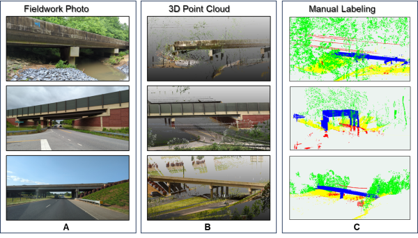
The study explores how Geospatial Artificial Intelligence (GeoAI) can help computers understand detailed 3D laser scans of bridges and surrounding environments. These scans contain millions of individual data points representing bridge components, vegetation, and the ground. Because of the large volume of data, an AI model may not directly analyze every point, which can leave gaps or inaccuracies in the final results.
The researchers tested a spatial method that uses information from nearby points to improve how these remaining points are classified. Using LiDAR data collected from bridges and related hydraulic structures, the study found that this approach can make AI-generated classifications more complete and accurate—particularly for complex or less clearly represented features.
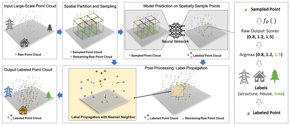
This research can support more reliable use of LiDAR and AI for bridge inspection, infrastructure monitoring, spatial measurement, and the development of 3D digital models. It also provides a practical way to improve the results of an existing AI model without requiring the model to be retrained.
The article, “Revisiting Deep Learning-Based Semantic Segmentation on Large-Scale Hydraulic-Structure LiDAR Point Clouds: A Spatial Surrogate Modeling Perspective,” was published in Remote Sensing in July 2026.